


It must be said that I have been on more ‘archaeological trails’ in Sweden than in the UK. In the UK there aren’t that many (but happy to be corrected) although see my discussion of the Maelmin heritage trail here and here. Hence, in good weather, today I was delighted to have the opportunity to finally try out the Brenig Archaeology Trail as set up by Welsh Water and Denbighshire Countryside Service. The archaeodeath dimension is clear. Many of the sites are Bronze Age mortuary and ceremonial monuments and hence this is a rare instance where a scattered ‘cemetery’ of mounds across hillsides in North-East Wales has been the focus of heritage interpretation.
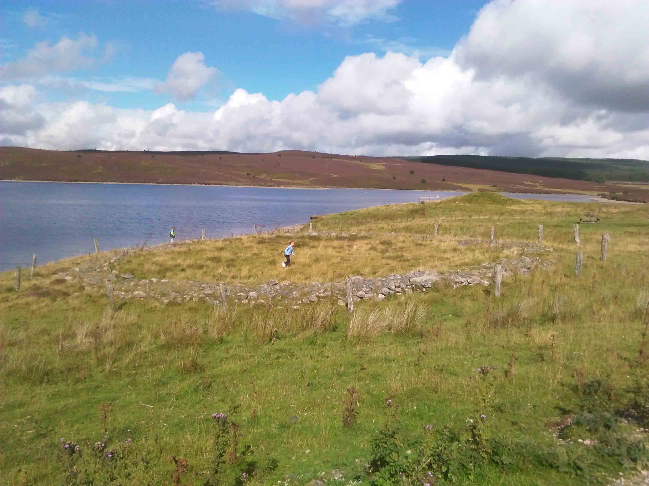
Actually this was a second attempt to explore Brenig. The first one being a bit of a disaster due to screaming kids. This attempt was far more successful but the screaming (and this time also vomiting) kids were back, impeding speed and coherent progress but adding all manner of humorous dimensions. The most dismissive and funny comment in this regard was upon reaching the kerbed cairn (7 on the archaeology trail) when my eldest exclaimed something like: “we’ve gone the wrong way again Daddy, you’ve brought us to a field full of only sheep poo”…


The trail takes in elements of a rich archaeological upland landscape explored by work done ahead of the construction of the Llyn Brenig reservoir in the 1970s. The fact that these parts of the landscape are not submerged is because plans for a second stage enlargement of Llyn Brenig were never completed.

For superb details of the trail and the archaeological sites along its way, I need not reiterate, but reference the walking trail available here on the Clwyd Powys Archaeological Trust website. There are a series of heritage boards and waymarkers that help to explain and guide you through the space. I can also strongly recommend the audio trail on Denbighshire County Council’s website narrated by the superb Frances Lynch: one of the directors of the archaeological work. Access it here.

Meanwhile, at the Llyn Brenig visitor centre there is a very strange mock-up of how Bronze Age ceremonial activities might have appeared against a backdrop of contemporary huts, with a board explaining about the activities of ‘Bronze Age man’ in the area.


Starting at the car park, we did part of the trail in a counter-clockwise direction. Because I was guiding 5 small kids, we decided to miss out the farthest Bronze Age kerb cairn (6 on the walking trail). Because the waymarkers have been taken down, we missed out on seeing the medieval sheep fold Hen Ddinbych (5 on the walking trail). Due to my son and eldest daughter attempted a bit of geese-droving, I managed to miss the early modern hafotai (3 on the walking trail).


Reflecting on the experience, I would say it was superb. I got to see a burial mound, ring cairn, kerbed cairn and platform cairn, many of which had long series of mortuary and ceremonial activity during the early 2nd millennium BC. I also got to see a 19th-century farmhouse.
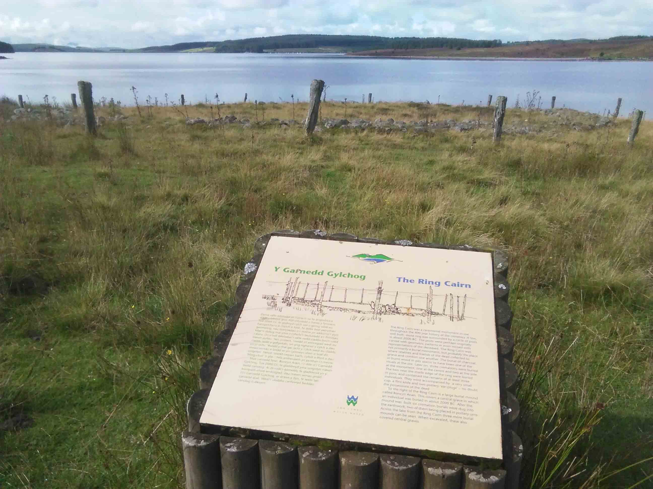
Regarding the trail itself, it is in some disrepair. We found two abandoned waymarkers dumbed at the kerbed cairn (7) and the toilets at the car park was closed. Still, the heritage boards – two different kinds, reflecting two stages of investment, were clear and give the walker a balanced nsight into a rich long-term archaeological history of the landscape from the Mesolithic to the 19th century as well as the wildlife to the observed in the area.
From an archaeodeath perspective, I must comment on the fact that most of the monuments resulted from long biographies of monument-building interspersed with (mainly) cremation ceremonies and the deposition of the cremated human remains. Deposits of charcoal were also recovered. Together this suggests the key significance of these monuments was fire and the transformation of the dead by fire. It strikes me as odd in this context that the heritage displays neither discuss nor visualise cremation practices or other fiery technologies in the Bronze Age. This is a great pity, since the varied and multi-staged practice of cremation was more than a ‘burial rite’.
Finally, I want to note that a further dimension of my interest in Brenig is the work I have done at the Pillar of Eliseg, where work with Nancy Edwards and Gary Robinson (Bangor University) has shown that the ninth-century cross had been installed upon a prehistoric burial mound of early 2nd millennium BC date. Seeing the mounds at Brenig made me reflect on the similarities between their forms and locations.

